Road Trip to: Hike in Western North Carolina
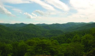
Western North Carolina offers a stunning backdrop for hiking enthusiasts, with its picturesque mountains that seem to touch the sky. As you trek through the winding trails, surrounded by lush forests and vibrant wildflowers, the panoramic views of the Blue Ridge Mountains unfold before you in all their majestic glory. The crisp mountain air invigorates your senses, while the sounds of birds provide a soothing melody. Enjoy some of the breathtaking vistas and see what Western North Carolina’s mountain trails have to offer to help leave a lasting impression on the soul. Hayesville Jack Rabbit Mountain Recreation Area: Take US 64E for 6.2 miles. Turn right onto NC 175, and go 2.5 miles. These 15 miles of trails are good for biking and walking of which many border Lake Chatuge while others meander through the woods or hilltops. The Jackrabbit Mountain Trail just outside the campground provides 2.4 mile easy trail loops through open woods with lake views. Fires Creek Wildlife Management Area : From Hayesville, take Tusquitee Street (SR 1300), go about 4.4 miles. Turn right on SR 1344 and go about 0.7 miles. The road turns into FR 340 (gravel). Several well known recreational trails + 25 mile Rim Trail follows the ridge around Fires Creek Wildlife Management Area. The trail, marked with blue blazes, has several access roads and trails. Shooting Creek Scenic Overlook: Take Hwy. 64 East from Hayesville towards Franklin, N.C. Perfect overlook area with tons of space to park and take in the scenery. Murphy river walk Located in downtown Murphy off Valley River Avenue the 3 mile walk beside the river starts or ends behind the Hackney Warehouse / Downtown Train Depot and Koneheta Park. A beautiful easy walk provides a mixture of shade and sun as it passes the trees along the river. Enjoy the park with playground for seating and picnic tables. Robbinsville Joyce Kilmer Memorial Forest From Robbinsville, take Highway 129 North for 1½ miles to the junction with Highway 143 West (Massey Branch Road). Turn left on Highway 143 and travel approx 5 miles to a stop sign. Turn right onto Kilmer Road. Drive for approx 7.3 miles and bear to the right at the junction of Santeetlah Gap and the Cherohala Skyway. Continue for another 2½ miles to the entrance of the Joyce Kilmer Memorial Forest. This shares the Nantahala & Cheoah Ranger District and has remained untouched by logging since 1936. This 2 mile figure-eight loop trail begins at the main parking area and climbs into Poplar Cove, where some tremendous poplars still grow today. The loops, connected in the middle, can be hiked in either direction. Lake Santeetlah located just north of Robbinsville is a separate lake where visitors enjoy fishing and boating. Nantahala River From Murphy go East on Hwy. 74 to travel past Andrews where the 4-lane Hwy. narrows to a 2-lane and winds through the Nantahala Mtns. & NFS. Enjoy the beautiful Nantahala River that winds along side this 10 mile stretch with [...]